Observation and survey · Tool 4 of 12
Drone and Aerial Site Survey
Use aerial imagery to reveal landscape patterns and change, then verify them on the ground before interpreting or designing a response.
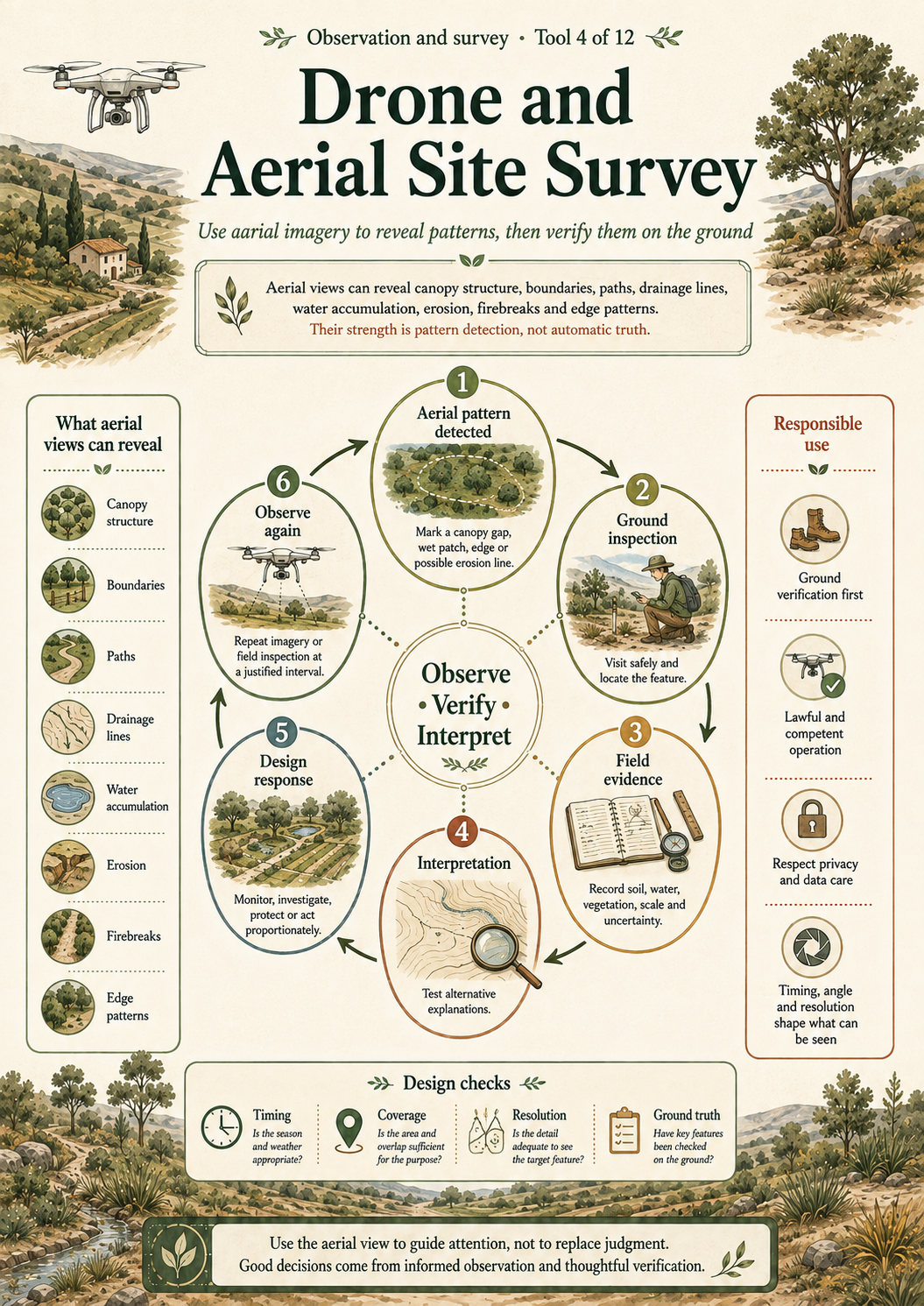
The detailed article and accessible semantic visual below provide the complete HTML text equivalent of the infographic, including its method, cautions and interpretation.
Why this tool matters
Aerial views can reveal canopy structure, boundaries, paths, drainage lines, water accumulation, erosion, firebreaks and edge patterns that are difficult to read from one ground position. Their strength is pattern detection, not automatic truth.
What the tool is
A drone or other aerial survey collects overhead or oblique imagery for mapping, comparison or inspection. The essential discipline is aerial observation → ground verification → interpretation. Image resolution, timing, angle and processing all shape what can be seen.
Origins and disciplinary context
Aerial survey comes from photography, remote sensing, surveying and aviation practice. Small drones have made imagery more accessible, but do not remove requirements for competent operation, lawful flight, privacy, data care or ground investigation.
The tool at a glance
Iterative aerial survey sequence from pattern detection to ground inspection, field evidence, interpretation and design response, with a return to further aerial or ground observation.
- Aerial pattern detectedMark a canopy gap, wet patch, edge or possible erosion line.
- Ground inspectionVisit safely and locate the feature.
- Field evidenceRecord soil, water, vegetation, scale and uncertainty.
- InterpretationTest alternative explanations.
- Design responseMonitor, investigate, protect or act proportionately.
- Observe againRepeat imagery or field inspection at a justified interval.
When to use it
Use for whole-site orientation, canopy and access patterns, seasonal comparison, post-event inspection or repeat change monitoring when aerial collection is lawful, safe and proportionate. Plan ground-truth points before drawing conclusions.
How to use it
- Define the survey question, area and necessary resolution.
- Check current aviation, airspace, privacy, protected-area and land-access requirements.
- Plan safe flight, weather limits, people protection and data handling.
- Capture consistent imagery and record flight metadata.
- Mark patterns and uncertainties without diagnosing from the image alone.
- Ground-check a representative set of features.
- Combine aerial and field evidence before deciding.
What to record
Record purpose, date, time, weather, platform, operator, flight area, altitude and camera orientation where appropriate, image identifiers, permissions, ground-control or reference points, detected features, ground verification, uncertainty and retention arrangements.
Worked example
Illustrative use: imagery suggests a pale linear feature downslope of a path. Ground inspection finds exposed soil but no active channel after ordinary rain. The designer records the feature, checks it after a significant event and avoids labelling it an erosion gully until field evidence supports that interpretation.
Connection with Mark’s Diploma practice
Design 08 names drone flyovers and photo monitoring for visual feedback and visual change tracking. The record supports their intended monitoring role, not any claim that imagery alone demonstrated ecological improvement.
Diploma source locators
- Design 08, PDF page 4: seasonal logs, biodiversity surveys, photo monitoring and drone flyovers.
- Design 08, printed page headed “Apply - Management Tools & Tracking”, PDF page 23: regular photo monitoring and drone flyovers.
- Design 08, Appendix 03, PDF page 75: drone flyovers and photo monitoring for visual change tracking.
Interpreting the results
Ask what ground evidence would confirm or challenge the apparent pattern. Compare equivalent season, light, height, angle and processing. Treat classification and change-detection outputs as evidence with error, not direct ecological explanation.
Limitations
- Canopy can hide ground conditions and image perspective can distort scale.
- Weather, shadows and seasonal colour can resemble change.
- Flights may be prohibited or inappropriate.
- Images can capture people and neighbouring property.
Common mistakes and misuse
- Assuming an aerial pattern explains its own cause.
- Flying without current official checks or competent control.
- Collecting more personal or neighbouring data than necessary.
- Comparing imagery captured under incompatible conditions.
Relationship to other Library tools
Reflection and application questions
- What can the image reveal, and what can it not reveal?
- Which features require ground verification?
- Is aerial collection necessary and proportionate?
References and further reading
- European Union Aviation Safety Agency, How to operate drones in the open category. Check current national airspace and privacy requirements before flight.
- Food and Agriculture Organization, participatory transect guidance, for the complementary role of ground verification and local knowledge.